The Darlington Trail (Piper-style!)

Darlington Trail Hike 10-31-14On Halloween Matt and I took Piper hiking on the Darlington Trail.  The Darlington Trail is a public hiking trail in Middletown Township, Delaware County, PA that winds along Chester Creek and an abandoned section of railroad that once connected Media to West Chester.  Naturally, I brought my camera along to document this adventure and wanted to share a few of my favorite shots here.

Warning… lots of cute puppy photos ahead!!! 😊

Piper loved climbing around on the train tracks and even walked on one track balance beam-style for a few steps.

Piper on the train tracks 3Piper on the train tracks 1Piper on the train tracks 2

In order to get a good photo angle of little Piper I ended up lying down on the tracks, which put me at the perfect level for a surprise puppy attack!

Surprise puppy attack on the tracks!

Piper was a total ham on the hike and kept pausing to look at the camera.

Piper 3PiperPiper the GSP PuppyPiper 2

Even when Piper got a break from walking she still made a point of looking at the camera!

Piper keeping an eye on me Piper takes a break from hiking

At the end of the hike little Piper happily snoozed in my arms on the drive home.  She is such a sweetie.

Piper sitting in the grass-

That’s it for this hike, but don’t worry, I have photos from a more recent hiking adventure that I will share soon!  🙂

Valley Forge Hike with our newest 4-legged house guest, Ganon

Happy Labor Day!  Matt and I have been enjoying a relaxing holiday weekend at home.  We raced The Pickle Run on Thursday, hiked on Friday, went to TWO barbecues on Saturday and did lots of yard work on Sunday.  At the moment we have nothing planned for today… that’s my favorite kind of day off!  🙂

We also hosted a new 4-legged house guest at our home this weekend, my step-brother’s pup, Ganon.  Friday was our first full day with Ganon so we took him hiking at Valley Forge National Park.  Matt and I have done the 5 mile paved Plumb Martin loop at Valley Forge several times but since we had Ganon along we wanted to try some hiking trails instead.  Every time we’ve done the paved loop we’ve seen a sign marking the turnoff for a pedestrian crossing over the (very wide) Schuylkill River.  I’ve always been intrigued by the river crossing so on Friday we decided to give it a try.

We parked at the Visitor’s Center and followed the paved loop north for a short while before turning off the trail towards the Schuylkill River.  From there we followed a road that dead-ended at what had been the old Betzwood Bridge (now just a precarious drop-off to the river!) before turning up a steep path to Highway 422.  The “pedestrian crossing” was a rickety 3 foot wide cantilevered walkway that was tacked onto the side of a major highway bridge several stories about the river.  Eek!  Not quite the peaceful hike I was expecting, but still very exhilarating (or terrifying, depending on your perspective).

Rt 422 Bridge Panorama over the Schuylkill

Despite some wobbly boards and lots of traffic whizzing by, we survived the bridge crossing and thankfully returned to ground level in the quieter, less tourist-y “north side” of Valley Forge.  (Where, for the record, there’s a perfectly good parking lot… We’ll probably drive over the 422 bridge and park there next time!)  I later read that ground has been broken for a brand new pedestrian/bike bridge that will be located at the site of the old Betzwood Bridge.  We’ll try the crossing again in May 2016 when the new bridge is supposed to be completed!

Matt and Ganon crossing the river

Once we arrived on the northern bank of the Schuylkill, we walked along the paved Schuylkill River Trail for a few minutes before transitioning down to the less-traveled gravel River Trail.  The River Trail hugged the river and offered gorgeous views of the water and woods.  We hiked for about 3 miles before turning around to make the trek back, but the trails kept going and we could have extended the hike quite a bit if we had wanted to.  There were a few spots where the path led right to the river which Ganon really liked.  🙂

The north side of Valley Forge was really beautiful and I’d recommend it to anyone looking to get away from the big crowds, tours, and reenactments that you’ll find on the more popular south side of the park.  I think Ganon would recommend it too… he had fun and was completely exhausted afterwards!

Sleepy Ganon

Here’s a map of our 6.2 mile hike shown in red on the VFNP North Side trails map.  You can view the official Park map on the NPS web site here: http://www.nps.gov/vafo/planyourvisit/upload/northside-2012.pdf

VFNP River Trail Map

Have a great Labor Day!

Birthday Walk at Ridley Creek

Last Friday was my birthday, woohoo!  Because we were entered to run in the Trinity 5K at 9AM Saturday morning we kept Friday’s celebrating pretty low key.  We got breakfast at Manhattan Bagel (my favorite) and worked a full day while hydrating like crazy for the race.  After work we took a nice walk with Bailey at Ridley Creek State Park before eating a pasta dinner and getting a good night’s sleep.  Here’s a photo of my Ridley Creek walking buddies… the perfect birthday companions!  🙂

380 Matt and Bailey

The weather was gorgeous during our walk.  Since we weren’t planning on doing any running in the park I brought my camera along to capture the beautiful autumn colors and my favorite photo subject, Bailey.  Here are a few of the photos I took:

Bailey hasn’t been to Ridley Creek State Park since I hurt my foot in late September.  She was so happy to be out and about again!  She was sporting her new ‘walkeez’ fleece harness and she paused for lots of photo ops.  She’s such a good dog!

Bailey

Hiking in the park with Matt and Bailey was the perfect way to spend my birthday.  What’s your idea of the perfect birthday afternoon?

Kirkwood Preserve

Guess what?  In 2 hours I will be running in my first distance race since 1999!!!  The 5K is hosted by Willistown Conservation Trust, a local non-profit land preservation organization in Willistown Township, Pennsylvania.  To prepare for the race I’ve been running like crazy on my treadmill AND, because the real world isn’t as flat and smooth as a treadmill, Matt and I have also been hiking (and sometimes jogging) in lots of local parks and preserves.

This week in honor of the upcoming race we visited Willistown Conservation Trust’s Kirkwood Preserve.

Kirkwood PreserveKirkwood features 83 acres of grasslands along a stretch of the picturesque Crum Creek.  The preserve has been classified as an “Important Bird Area,” meaning that you’re likely to see some endangered grassland birds on your hike.  More importantly (for me, at least) this also means that dogs are strictly prohibited from all areas of the preserve.

Kirkwood Tree

I actually have a very personal connection to the rolling hills of Kirkwood Preserve because I grew up about 2 miles away from here.  When my brother and I were kids we would walk here from our house with my mom all the time.  This was back before the land was preserved (it was just a cow farm then) and we spent hours and hours of our childhoods here hiking, playing, cross-country skiing, fishing, picnicing… you name it!  With all of those memories in mind it was really neat to come here with Matt and see that the land is still here and open to all.  (Of course the barbed-wired cow fences are all gone and the fields are full of natural grasses now, but that’s fine with me!)  Here are some photos from our walk:

Kirkwood Preserve is open daily from sunrise to sunset and has well-mowed walking trails.  We did the outer loop on our visit and our total walk was just shy of 2 miles.  The only access to the preserve is via the gravel parking lot on Grubbs Mill Road.

Kirkwood Map

OK… time for Matt and me to start stretching and getting ready for the race!  Here’s my running tally as of yesterday evening:

Miles since last post:  60.2
Days since last post:  11
Average Daily Miles since July 18th: 5.56
TOTAL MILES: 361.2

Wish us luck at 4pm…!  🙂

Kirkwood Jump

Other local hikes, parks, and preserves:

Ridley Creek State Park (Edgmont Township, PA)
Okehocking Preserve (Willistown Township, PA)
Darlington Trail (Middletown Township, PA)
Linvill Trail (Middletown Township, PA)
Stroud Preserve, (West Chester, PA)

Stroud Preserve

Last weekend Matt, Bailey and I took a hike in the beautiful Stroud Preserve located just west of West Chester, Pennsylvania.  This was our first time visiting this nature preserve and we really enjoyed the rolling hills, scenic views, and well-marked trails.

Stroud Preserve is maintained by Natural Lands Trust, a non-profit land conservation organization in southeastern Pennsylvania.  According to the NLT web site:

Stroud Preserve consists of 571 acres of culturally and ecologically important land in Chester County. This rolling mosaic of once-pastured grasslands, working farmlands, and woodlands now serves as wildlife habitat and a unique site for research by the Stroud Water Research Center, one of the premier stream research labs in North America.

Here are some photos from our hike on Saturday:

If you’re looking for a peaceful, natural area to hike in southeastern Pennsylvania l would definitely recommend paying a visit to Stroud Preserve.  The preserve is located at 454 North Creek Road, West Chester, PA 19382 and a copy of NLT’s trail map is below.

STROUD-H1-MapPlease note that only the trails marked with solid lines are dog-friendly and dogs should be kept on leash at all times.  With this in mind we took Bailey on the Yellow Trail loop with a detour onto the Gray Trail to avoid the no-dogs area and we finished up around the northern part of the Purple trail.   Our hike was about 3.2 miles long.  If we go back sometime without Bailey (which is unlikely since she LOVES going hiking!!) we’d probably try the full red loop which is supposed to be 4.2 miles long.

Bailey loves hiking!

Bailey loves hiking!

Here are links to some other hiking spots in Chester and Delaware County, PA that I’ve blogged about.  Enjoy!

•   Ridley Creek State Park (Edgmont Township, PA)
•   Okehocking Preserve (Willistown Township, PA)
•   Darlington Trail (Middletown Township, PA)
•   Linvill Trail (Middletown Township, PA)

Stroud Preserve Cornfield

Ridley Creek State Park

In honor of my 100th post (yes, it’s my 100th post!) I’m going to feature one of my very favorite hiking spots ever:  Ridley Creek State Park.  “Ridley Creek,” as we call it, is a 2,600 acre park located in Delaware County, Pennsylvania, approximately 15 miles west of Philadelphia.  It also happens to be about 2 miles from our house which makes it a very convenient place to enjoy nature while getting some exercise!

Ridley Creek State Park Map (TheLittleGSP.com)

Matt and I both grew up in this area so we’ve been coming to Ridley Creek State Park with our families since long before we met one another in college.  Come to think of it, we both spent SO much time here as kids that it’s actually pretty likely that we unknowingly passed each other on the bike trail or splashed around in the creek together at some point in our childhoods.

Ridley Creek features miles of secluded hiking trails, multiple family-friendly picnic areas, and a 4.5 mile paved trail.  The paved trail is popular with walkers, runners, and bikers.  The trail has mile-markers every tenth of a mile and the scenery along the way includes thick woods, cornfields, deserted 19th century stone houses, and, of course, Ridley Creek itself.  Matt, Bailey, and I walk this trail fairly often.  Most recently we went on Day 14 of my mile-a-day “Streak” and the next day I was definitely feeling the combined effects of the hilly 4.5 mile walk and my morning mile!

In addition to the paved trail, Matt and I also enjoy hiking in the much more secluded northern section of the park.  This area is usually utilized by horseback riders but we started to frequent it after discovering an off-road hunter’s parking lot (1) near our house last February.  The 4.25 mile trail can be a bit difficult to follow if you don’t know where you’re going but I love how sections of it makes you feel like you’re 100 miles away from civilization or, better yet, like you’ve gone back in time.  In fact, if you follow the gas pipeline right-of-way up the (very steep) hill you’ll actually come across a forgotten cemetery that hails back to the 1800s.  Cool!

If you’re ever in Delaware County looking for a good place to take a hike I’d definitely recommend stopping by Ridley Creek State Park.  If you have been to Ridley Creek before please let me know what your favorite trail is in the comments section below!  🙂

Related Links:

The Darlington Trail (Middletown Trails)

As the weather gets cooler I find myself getting the urge to go hiking in the woods with Matt and Bailey.  We took a nice 2 mile walk at Okehocking Preserve last week but, since that’s already been featured on my blog, I thought I’d write about another one of our favorite hiking spots: Darlington Trail in Glen Mills, Pennsylvania.

The Darlington Trail is part of the wonderful “Middletown Trails” network that is owned and maintained by Middletown Township.  You can view a map showing the rough location of each of the six trails in my Linvill Trail post from last March.

One of my favorite parts about the Darlington Trail is that it crisscrosses an old rail line.  These tracks used to carry passenger trains from Media to West Chester (an extension of the current-day Septa R3 Media/Elwyn line) but now they are only used by the occasional freight train traveling at night towards Philadelphia from a nearby quarry.  We’ve never seen a train on this stretch of tracks during the daytime so we always feel very safe walking along (or on!) the tracks.

The train tracks cross high over the Chester Creek in two spots.  I wouldn’t recommend trying to walk across the rail bridges on foot because the space between each of the railroad cross ties is completely open to the creek 30 or so feet below.  Seeing the water rush by below your feet is pretty disconcerting when you are standing on a bridge that’s only a couple of feet wide with no handrails or guardrails!

The first time we hiked the Darlington Trail we were exploring the tracks and somehow ended up on the wrong side of one of the bridges.  Bailey definitely would have fallen right through the holes between the ties if we had tried to walk on the bridge so Matt concluded that the only way to get her to the other side was to carry her.  Luckily she was very calm and stayed perfectly still while Matt tiptoed from tie to tie across the bridge!  (Note: you do not have to cross the bridges in order to hike the trail!)

The bridge doesn’t look very intimidating from here, but when you get closer and realize that there’s nothing but air between the rail ties it might make you feel a bit unnerved when walking over it!

The terrain is quite varied on the Darlington Trail.  At some points you snake along the wide bank of Chester Creek (great for dogs who like the water!) and in other spots you hike through rolling farmlands and are rewarded with a great view of the surrounding area and the trail as it continues on in the distance.

According to the trail map, the entire loop is about 2.75 miles long.  The trail is well maintained and is clearly marked with yellow diamond-shaped trail signs.  We usually park in the lot located on Darlington Road just north of the road’s intersection with Route 1 / Baltimore Pike in Glen Mills, PA.  You can also park near the original Wawa dairy (yes, THE Wawa!) on Valley Road just north of Route 1.

If you live in the Delaware County/Chester County area and ever decide to hike the Darlington Trail I would love to hear what you think of it!  Do you have a favorite section of trail (or does your dog have a favorite section of the creek?)  🙂  Please share!

The Grand Canyon of… Vermont?

We spent our Memorial Day weekend in Quechee, Vermont with Matt’s family.  Quechee is a tiny town nestled on the banks of the Ottauquechee River. It took us about 7 1/2 hours to drive to Quechee but once we got there the lush green mountains and river views made the long drive worth every minute.

The town is home to the Quechee Gorge – “Vermont’s Grand Canyon.”  Here are some photos from our trip, enjoy!

View of Quechee Gorge from Route 4 Bridge (aka from the “top.” We walked all the way to the bottom!)


Route 4 Bridge over Quechee Gorge… beautiful!

At the bottom of the gorge the river widened into this vast “delta” of crystal clear water. Dozens of people were scattered around enjoying the water and sunny 80° weather.

A view looking back up the gorge – gotta love that perfect blue water!

Quechee Covered Bridge: The Quechee Covered Bridge crosses the Ottauquechee River in the heart of the village of Quechee. Sadly this bridge and a few of the surrounding buildings were badly damaged during Hurricane Irene in August 2011.

Another casualty of Hurricane Irene – the Taftsville Covered Bridge. We took a gravel road to get from Quechee to Woodstock, VT and passed right by the closed entrance of this beautiful old bridge.

Here we are at the bottom of the Quechee Gorge… what a fun trip!

Linvill and Indian Orchard Trails (Middletown Trails)

A few years ago when we lived in Media we discovered that there were miles of hiking trails in our neighboring township.  While this kind of revelation may not be that shocking for many people in most parts of the country, we live in the Philadelphia suburbs and this was quite a pleasant surprise for us.  We immediately started to explore the Middletown Township Trails and have since hiked each of the six trails multiple times.

General Location of each of the Middletown Trails

One of our favorite trails is the Linvill Trail.  It follows the perimeter of the awesome Linvilla Orchards, home of pick your own apples (and blueberries, peaches, strawberries, you name it), a brand new garden center, haunted hayrides, and, my favorite, cut your own Christmas trees.  We’ve cut down a tree with Matt’s family for the past 6+ years and we always get our tree (a frazier fir) from the pre-cut tree area in the market.

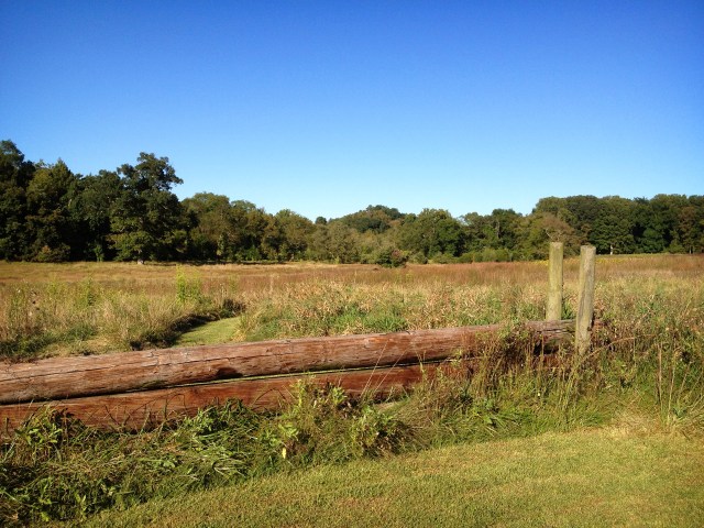
A field of Linvilla Christmas Trees

The Linvill Trail and its neighbor, the Indian Orchard Trail, wind around through beautiful, quiet woods and wide open fields.  I especially like the few spots where you suddenly stumble upon an old, crumbly spring house, a ‘hidden’ swim club, or, (my absolute favorite!!) abandoned railroad tracks.  You can take an easy detour off of the Linvill Trail and visit the Chester Creek Branch, a single track that is completely falling apart and overgrown.  (But be careful, parts will collapse and slide into Chester Creek if you don’t watch your step!!)

Eventually the Chester Creek Branch is supposed to become a Rail-Trail.  Although I know that this will be great for the overall community, I love seeing the actual abandoned tracks and having the right-of-way to ourselves.  It just won’t be the same once it’s paved over and populated with bikers and runners… Oh well!

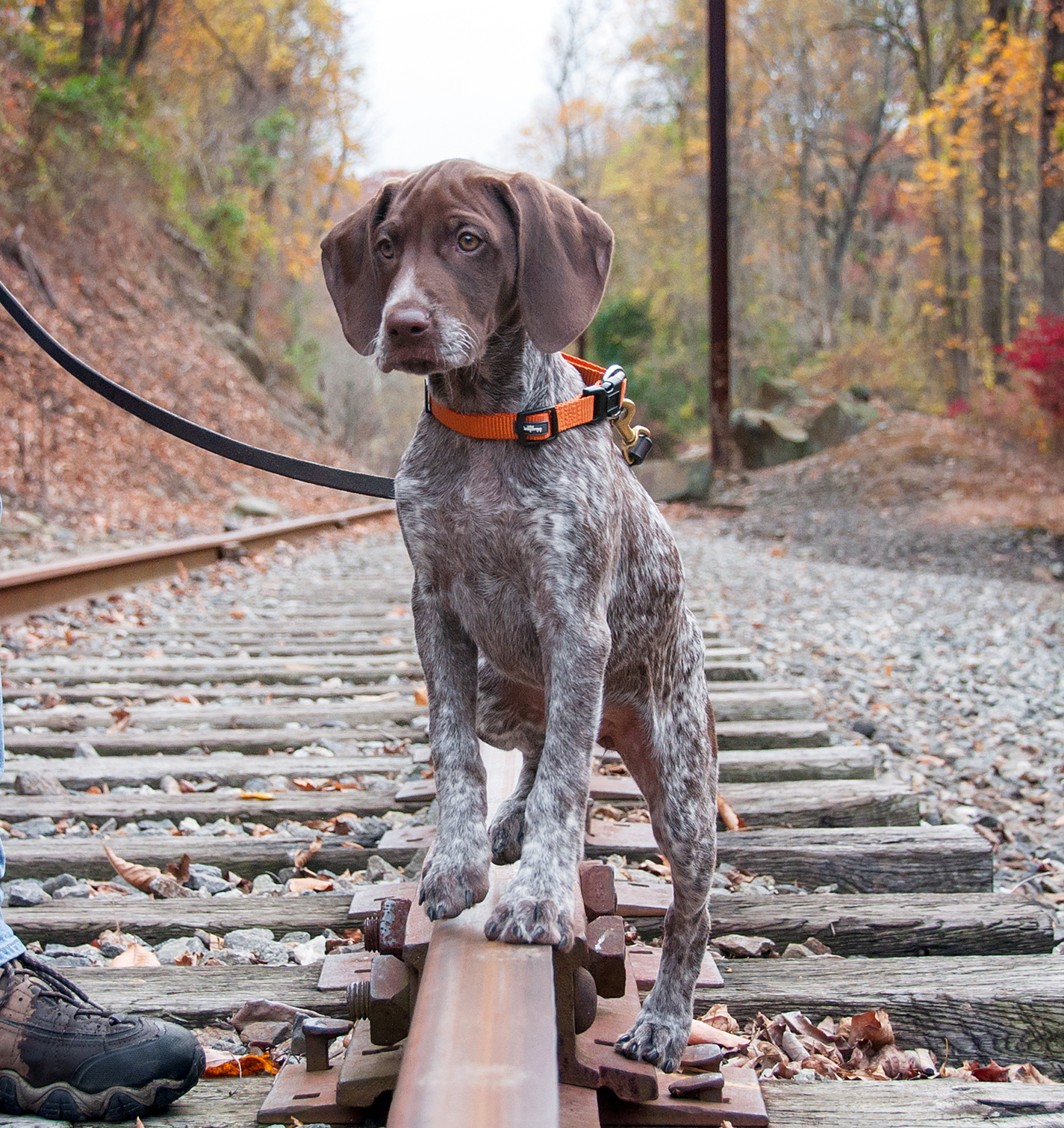
Bailey on the Chester Creek Branch tracks looking down over Chester Creek

Another underutilized right-of-way on the Linvill Trail is the huge swath of land that has been cut back for a gas pipeline.  Although the initial lack of vegetation can be a surprise at first, I like pipeline right-of-ways because they create a whole new open area in the woods to explore.  Every once in a while you’ll come to a point where you can see along the pipeline for several hundred yards which is kind of a neat sight in an otherwise dense forest.  According to the township map, this pipeline is also slated to become a ‘future trail’ at some point.

Matt and Bailey walking down the Linvill Pipeline Right-of-Way

I’ll finish this post off with another photo of the beautiful fields of Linvilla Orchards.  For more information on the Linvill and Indian Orchard Trails, check out the trail map (with my notes!) or visit the Middletown Township Trails web site!

Linvilla Orchards

Linvill & Indian Orchard Trail Map (with my notes!) click to enlarge

Okehocking Preserve

I just realized that there’s another topic that I’d like to write about in addition to recipes and Bailey updates — places we like to Hike!

Okehocking Preserve in Willistown Township, PA

Matt, Bailey and I have explored parks and preserves all over Delaware and Chester County, often in pursuit of geocaches. We have several favorite places that we like to hike including Okehocking Preserve in Willistown Township, PA. Okehocking is bounded by West Chester Pike to the south and Delchester and Garrett Mill Roads to the east and west, respectively.  It’s full of rolling hills and mowed hiking trails and, best of all, it’s less than a mile from our house.  From the top of one of the hills you can actually see our house!

You can see our house from this hill at Okehocking (and no, it's not the stone one...)

In addition to the beautiful landscapes Okehocking also has an off-leash dog park.  Unfortunately for Miss Bailey the park is not fenced so she’s not going off-leash there anytime soon, but it is fun to watch the other dogs run around.  Last year we saw a female GSP at Okehocking and after a quick chat with her owner realized that she was Bailey’s sister!!!  Bailey was born in New Jersey so finding her littermate romping at a park a mile from home was pretty crazy.

We discovered Bailey's sister, Kona, playing in the off-leash park at Okehocking

Just in case it seems that we only visit Okehocking in the dreary winter months, here’s a photo from last fall.  Enjoy!